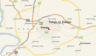
Daegu
 |
 |
It is the third-largest urban agglomeration in South Korea after Seoul and Busan; it is the third-largest official metropolitan area in the nation with over 2.5 million residents; and the second-largest city after Busan in the Yeongnam region in southeastern Korean Peninsula. Daegu and surrounding North Gyeongsang Province are often referred to as Daegu-Gyeongbuk, with a total population over 5 million.
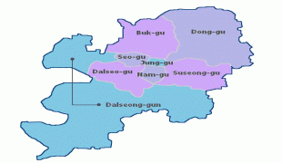
Daegu is located in south-eastern Korea about 80 km from the seacoast, near the Geumho River and its mainstream, Nakdong River in Gyeongsang-do. The Daegu basin is the central plain of the Yeongnam region. In ancient times, the Daegu area was part of the proto-kingdom Jinhan. Subsequently, Daegu came under the control of the Silla Kingdom, which unified the Korean Peninsula. During the Joseon Dynasty period, the city was the capital of Gyeongsang-do, one of the traditional eight provinces of the country.
Daegu was an economic motor of Korea during the 1960s–1980s period and was especially known for its electronics industry. The humid subtropical climate of Daegu is ideal for producing high-quality apples, thus the nickname, "Apple City". Daegu is also known as "Textile City". Textiles used to be the pillar industry of the city. With the establishment of the Daegu-Gyeongbuk Free Economic Zone, Daegu is currently focusing on fostering fashion and high-tech industries.
Daegu was the host city of the 22nd World Energy Congress, the 2011 World Championships in Athletics and the 2003 Summer Universiade. It also hosted four matches in the 2002 FIFA World Cup.
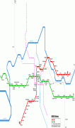
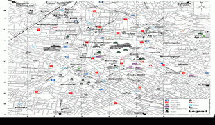
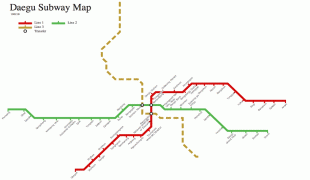
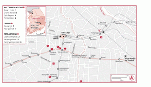
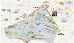
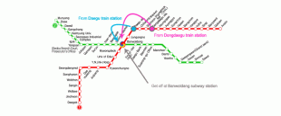
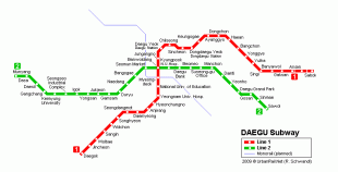
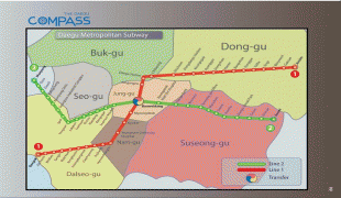
Map - Daegu
Map


Country - South_Korea
 |
 |
| Flag of South Korea | |
The Korean Peninsula was inhabited as early as the Lower Paleolithic period. Its first kingdom was noted in Chinese records in the early 7th century BCE. Following the unification of the Three Kingdoms of Korea into Silla and Balhae in the late 7th century, Korea was ruled by the Goryeo dynasty (918–1392) and the Joseon dynasty (1392–1897). The succeeding Korean Empire (1897–1910) was annexed in 1910 into the Empire of Japan. Japanese rule ended following Japan's surrender in World War II, after which Korea was divided into two zones; a northern zone occupied by the Soviet Union and a southern zone occupied by the United States. After negotiations on reunification failed, the southern zone became the Republic of Korea in August 1948 while the northern zone became the communist Democratic People's Republic of Korea the following month.
Currency / Language
| ISO | Currency | Symbol | Significant figures |
|---|---|---|---|
| KRW | South Korean won | â‚© | 0 |
| ISO | Language |
|---|---|
| EN | English language |
| KO | Korean language |
